Adam's Mill
The Abandoned Adam's Mill Dam Trail
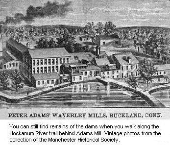
Tucked behind a once flourishing paper mill turned restaurant and now brewery, sits the remains of the original dams and water ways that were constructed around the end of the industrial revolution. Bordering the Hockanum river, this was the perfect spot that allowed Peter Adams to succeed and become one of the most prominent paper mill owners in the world. After a flood in 1869, Adams Pond was created to bring water directly to the mill. However, a blizzard in 1938 destroyed all the dams and sandstone dikes that created the pond, bringing an end to the amazing waterway production area, aside from some remaining foundations and structures.
The Adam's Mill Trail loop has a few different routes. I'm going to offer the one that I feel is most direct. From the parking lot to the left of the old Adam's Mill (Restaurant), now Elicit brewing, a sidewalk with a map sign at the beginning will lead you up a short hill and over a water gate directly next to the building. There is no water here anymore as it was part of the pond design when they needed water at the building. Continue to follow the trail, taking a right as it splits and head behind the buildings, passing a dog daycare and training facility. You will gradually approach the river and depending on the time of year and foliage, you should arrive upon a similar sight.


This building is the remaining structure of the hydroelectric facility, circa 1907. To the left in the river lie the large sandstones that originally constructed a dam, now dispersed and non functional, however mostly intact, due to many years of storms.

Interestingly, due to the dam being non functional, you can walk right under the structure where the water wheel would have originally sat, and continue right into the 'basement' of the building itself.

From underneath. In the next photo, note the small opening in the corner of room. There are metal ladder rungs inside. I did climb it, however consider that they are over 100 years old and are not in the best condition

The interior of the building. Except for the bare window frames, nothing remains from the days when power was produced here.

Exterior of the west side of building. Surprisingly still in great shape structurally. To the right, down a small hill, is the remains of the dam and a tall wall of sandstone directly next to the building. Fun to climb on and depending on the water level you may see quite a few in the river.
The trail then turns back upstream, following the edge of the riverbank. Continue for awhile and you will see a trail branch off to the left. If you only care to see Adam's Mill related locations, take a left here. However, continuing along will bring you to a few interesting places.

As you approach a train trestle (Circa 1850), you will take a zig zagging path uphill that will place you at the western side of it. NOTE: Hikers should not cross the railroad bridge to get to the south side of the trail. Instead, those wishing to hike the other side should backtrack to Adams Street and cross the small Adams Street bridge over the Hockanum River there, to get to the south side of the river, and the trail access behind the former DeCormier Nissan dealership.
This is taken directly from the HRWA. I do not condone crossing. However, structurally speaking the bridge is safe, if you were to find yourself needing an 'escape route'.
Now, you're on the eastern side of the river, however you decided to get there. You'll stumble across this unique building, tougher to see when foliage is grown in.

To the best of my knowledge, this was most likely some type of pump house for the 8th Utilities District of Manchester, who was originally the property tenant, providing fire department and other municipal services up until the 1950's.

Take note the property is currently owned and used by the Town of Manchester, so don't be surprised and also be aware of any trucks or heavy equipment on the grounds. However, this building is very clearly not used.

This is the roof of the facility. Unfortunately the sun was setting quickly and their were a few employees on the grounds so there wasn't a further investigation of where the open access hole lead to. You can walk up the hill around building to see this, however there is a fence around the easily accessible parts.
Now we head back. Returning to the west side of the river where we started, return on the same trail until you come across the split I mentioned before. Following this to your right, you will notice a peculiar formation of sandstones. The structure is quite a bit larger than this picture shows.

The dam itself dates back to 1867. However, the carvings are more modern and not entirely original, although there is no exact date. You can climb on, in and around this structure. After this, follow the trail onward and you will find yourself back at the water gate next to the restaurant.
Summary
This is a great, easy hike that is suitable for all ages. Although not much remains, these structures range from 100-150+ years old, and are a great hands on and real life visit to some of Manchester's original history. Online maps and directions are very easy to find, and the trails are well blazed.
Comments
Post a Comment
Questions or Comments Always Welcome!